I’m going to not wade into the fact that you are almost definitely hearing about post-partum depression a lot because it is a mid-term election year in the United States (though you most likely are). In 2024, there was a certain track meet. 2020 I don’t even have to talk about.
Let’s just say certain patterns persist.
The less emotionally draining side of this same conspiratorial coin — though frustrations do run deep — is people trying their absolutely hardest to Both Sides™ the UN’s adoption of Equal Earth Projection maps.
Just today, this post popped up like so many others on Reddit as of late…
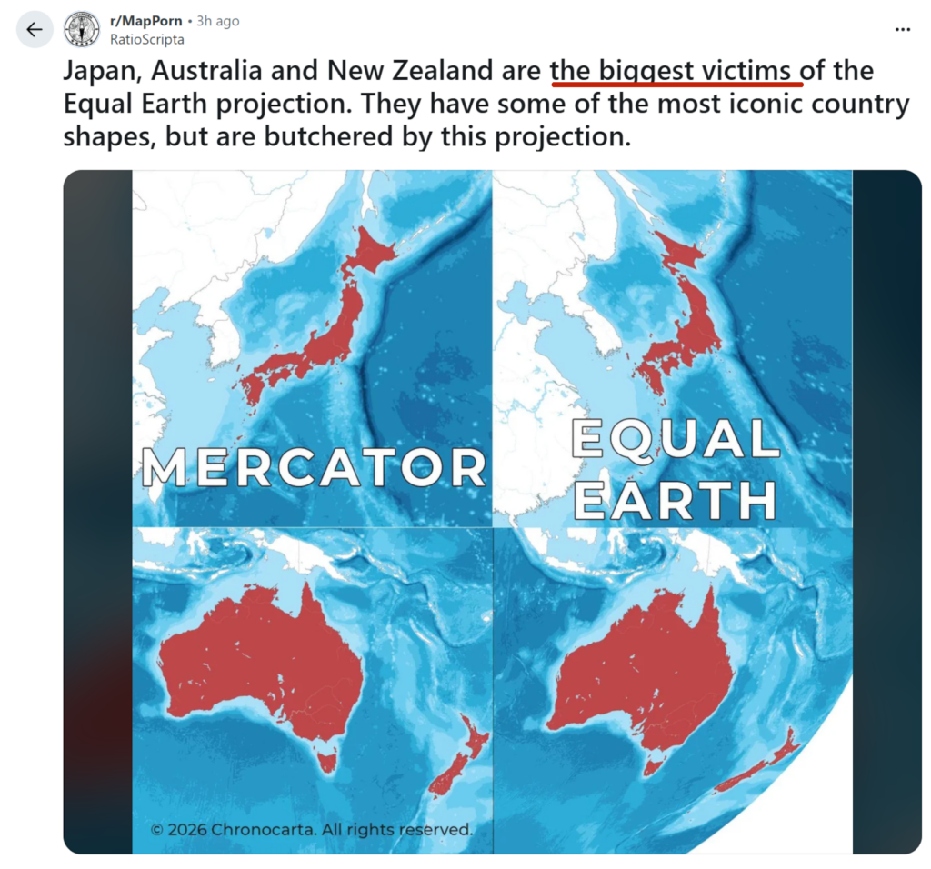
Obviously, I highlighted the text to bend it to my argument but the fact that the poster [whose name I kept in if you want to look some of their stuff, which does include some quite interesting map discussions besides this] felt to describe this in terms of victimhood just shows how people are baking the argument into the pretense of a statement. Begging the question or some such legal term. The mind boggles. Et cetera.
“Biggest victims…” Lord save us from Redditors. Could have just said something like “have the largest distortions in Atlantic centric versions of the maps” or whatever.
I legit feel that certain algorithmic forces are trying to poke this bear and ride the US-defaultism nature of sites like Reddit, Youtube, Facebook, etc to try and convince you that you should feel victimized by a map. Maybe I am just really unlucky. Who knows.
OP is also just wrong. Here’s what the above would look like if they had used the Pacific centered version of the map (which honestly gets more landmasses right so I don’t mind it, even as an Euro-located person, sorry Greenland/Iceland).
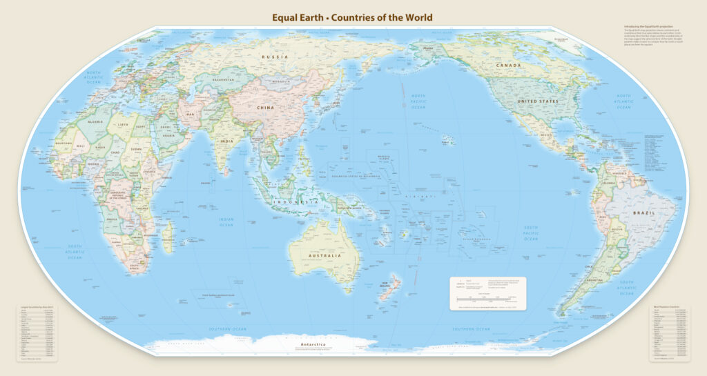
Heck, several places already use projections that are closer to to Equal Earth than Mercator. Go look at stuff like Winkel Tripel and Robinson Projections.
Good for all the people learning this past week that not everyone uses the same Atlantic-centered Mercator map (even if they end up preferring what they know). It is a nice moment to find out how other people do such things.
For the record, my favorite is probably something like Dymaxion or Hao’s Projection. Pole focused maps make the various landmasses much more interesting to me.
Also, we are now in the era where digital maps and the ability to have multiple projections at once makes this very, very moot. Different maps for different tasks.